
Torres del Paine guide: the W Trek and O Circuit
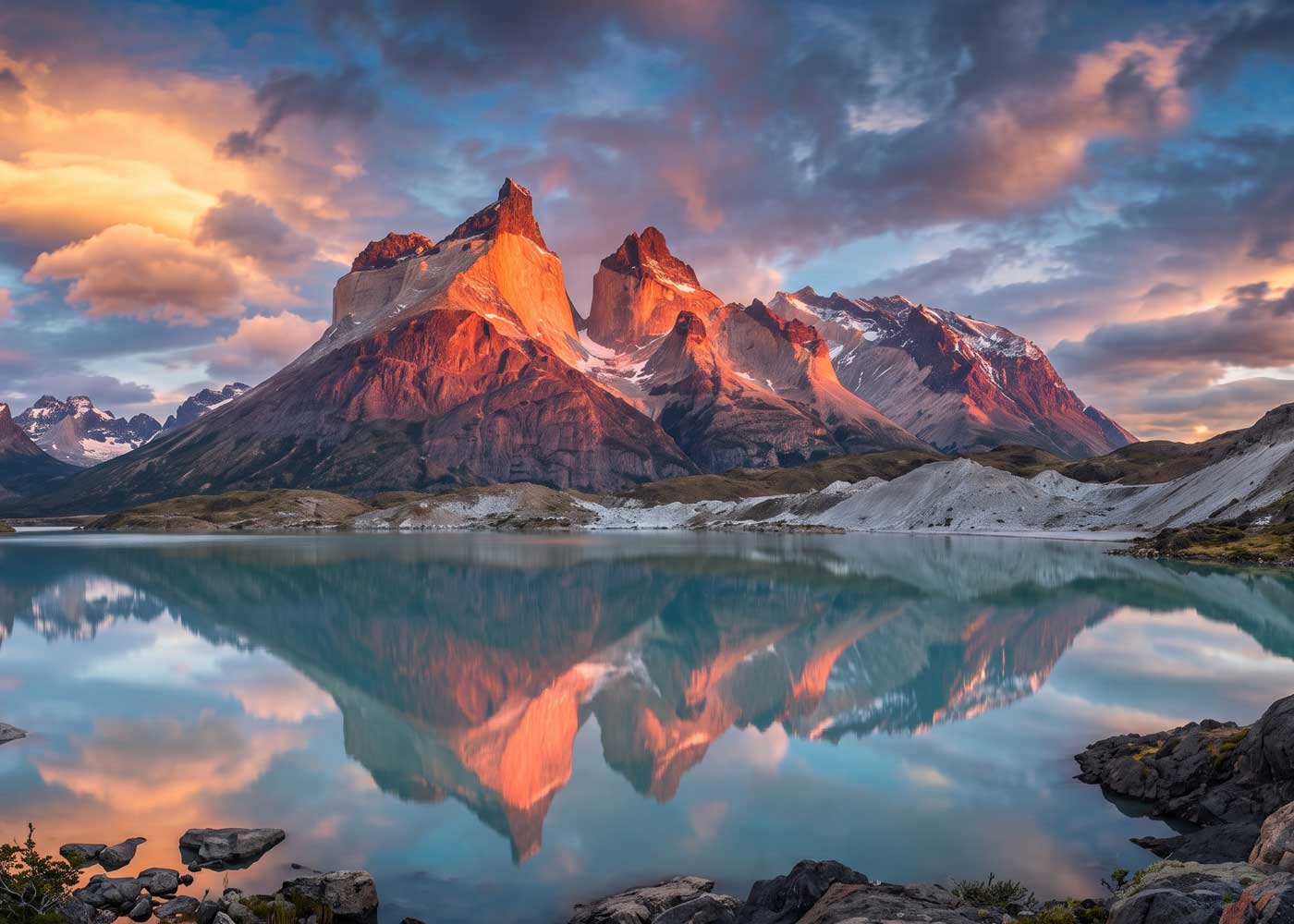
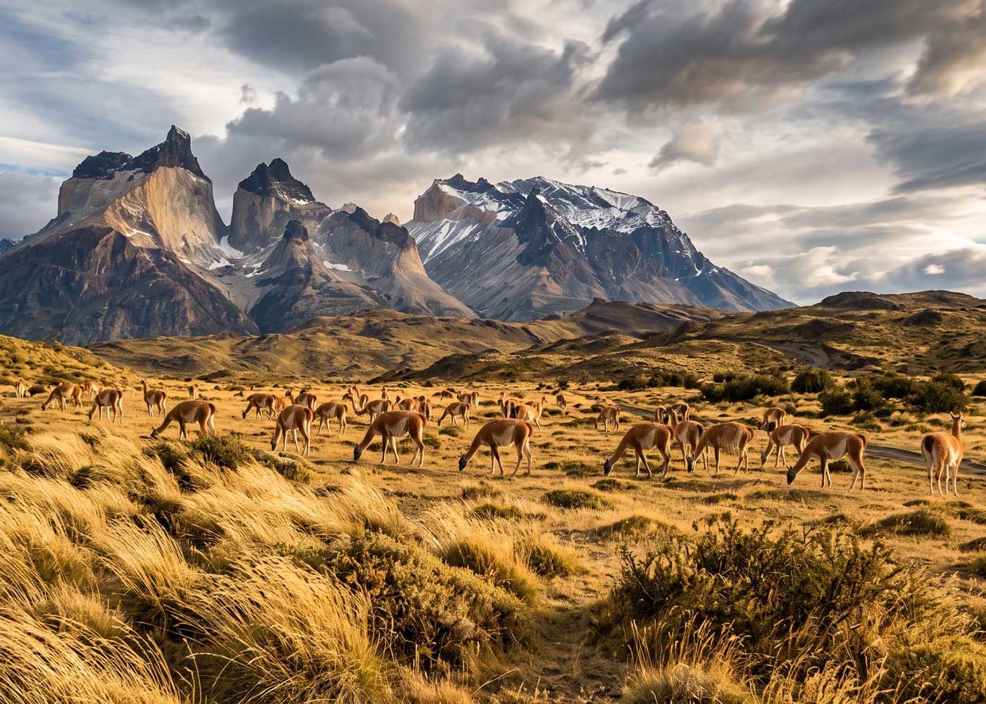
Three granite towers rise some 1,200 meters of sheer wall above the Patagonian steppe. Wind screams across glacial lakes at 100 kilometers per hour. Guanacos graze beneath peaks that took 12 million years to form.
This is Torres del Paine National Park, and it demands preparation.
According to CONAF visitor statistics, the park attracts over 250,000 visitors annually, yet many arrive without understanding the booking systems, weather patterns, or route options that determine whether their trek becomes a lifetime highlight or a logistical nightmare.
This guide exists to prevent the latter.
You’ll find complete breakdowns of the W Trek and O Circuit, month-by-month weather analysis, permit and refugio booking strategies, Patagonia-specific gear requirements, and realistic budget projections. Whether you have four days or ten, prefer refugio beds or tent floors, this guide provides the planning framework for Torres del Paine.
What Is Torres del Paine?
Torres del Paine is a national park in Chilean Patagonia covering 227,000 hectares of mountains, glaciers, lakes, and steppe. Located 112 kilometers north of Puerto Natales, the park is named for three granite towers (torres), the highest of which reaches 2,500 meters. UNESCO designated it a Biosphere Reserve in 1978. According to CONAF (Chile’s National Forest Corporation), the park received over 250,000 visitors in the 2023-2024 season, making it Chile’s most visited national park.
Torres del Paine National Park: Geography and Layout
Torres del Paine National Park covers 227,000 hectares of Chilean Patagonia, according to CONAF records. UNESCO designated it a Biosphere Reserve in 1978, recognizing ecosystems that span from Patagonian steppe to glacial ice fields within a single day’s hike.
The park sits 112 kilometers north of Puerto Natales, the gateway town where most trekkers base their preparations.
The Three Towers and Cuernos del Paine
The park’s namesake towers, Torre Sur, Torre Central, and Torre Norte, are granite pillars that survived while surrounding sedimentary rock eroded. Torre Sur is the highest at roughly 2,500 meters, followed by Torre Central at about 2,460 meters and Torre Norte at about 2,260 meters. Their near-vertical walls rise around 1,200 meters above the base.
The towers formed when magma intruded into existing rock approximately 12 million years ago. Glaciers sculpted the surrounding valleys, leaving the harder granite standing as three distinct spires. Reaching their base requires an 8-10 hour day hike or forms the climax of the W Trek’s eastern section.
Equally dramatic but less photographed, the Cuernos del Paine (Horns of Paine) feature the same granite cores capped by dark sedimentary rock that creates their distinctive striped appearance. These peaks dominate views along the W Trek’s central sections.
Key Valleys and Lakes
Three major valleys form the “W” shape that gives the famous trek its name:
Valle Ascencio runs northeast toward the base of the towers. This valley contains the steepest terrain on standard trekking routes, with a final boulder field requiring scrambling to reach the iconic Mirador Torres viewpoint.
Valle del Frances (French Valley) cuts into the heart of the Paine Massif. The 9-kilometer side trail from Campamento Italiano climbs through lenga forest to Mirador Britanico, where you’re surrounded by hanging glaciers and vertical rock faces.
Valle del Grey leads to the park’s largest glacier. Grey Glacier flows from the Southern Patagonian Ice Field, calving icebergs into Lago Grey. This valley offers the W Trek’s most accessible glacier views.
Major lakes include Lago Nordenskjold (which you’ll walk beside for hours on the W Trek), Lago Pehoe (home to the catamaran crossing), and Lago Grey (where icebergs float beneath the glacier).
Park Zones and Access Points
Three main entry points serve different purposes:
Laguna Amarga serves trekkers starting the W Trek eastbound or heading directly to the towers. A catamaran crosses the laguna to reach trailheads.
Pudeto provides ferry access across Lago Pehoe for westbound W Trek starts or day trips to Paine Grande.
Administracion functions as the park’s central hub with the main ranger station, where you can extend permits, get weather updates, and access trails to Salto Grande waterfall.
What Is the W Trek?
The W Trek is an 80-kilometer, 4-5 day hiking route through Torres del Paine National Park that connects three major valleys in a “W” shape. It passes glacier viewpoints, alpine lakes, and the base of the granite towers. No technical climbing is required, though the trek demands solid fitness and advance booking of refugios or campsites.
The W Trek: Patagonia’s Most Popular Multi-Day Hike
The W Trek covers approximately 80 kilometers over 4-5 days, connecting the park’s three major valleys. The route traces a “W” shape when viewed from above, with each point of the W representing a destination valley.
This trek ranks among South America’s most popular multi-day hikes for good reason: it concentrates Torres del Paine’s highlights into a manageable itinerary accessible to fit hikers without technical mountaineering experience.
W Trek Route and Daily Distances
The standard W Trek breaks into four or five days depending on pace and accommodation choices:
| Day | Section | Distance | Elevation Gain | Hours |
|---|---|---|---|---|
| 1 | Welcome Center to Chileno/Torres | 11 km | 800m | 4-5h |
| 2 | Chileno to Mirador Torres to Cuernos | 18 km | 400m | 8-10h |
| 3 | Cuernos to Frances to Paine Grande | 22 km | 500m | 8-9h |
| 4 | Paine Grande to Grey Glacier and return | 22 km | 300m | 7-8h |
| 5 | Paine Grande to Pudeto (ferry) | 7 km | minimal | 2-3h |
Distances and times vary based on direction and specific refugio choices. The figures above assume an eastbound direction starting at Las Torres.
Day-by-Day Breakdown
Day 1: Arrival and Ascencio Valley
Most eastbound trekkers arrive at the Las Torres sector by mid-morning. After registering at the welcome center, the trail climbs gradually through open terrain before entering lenga forest. Refugio Chileno sits approximately two-thirds of the way to the towers, providing an overnight option that shortens Day 2.
Day 2: Mirador Torres and Traverse
The pre-dawn start for sunrise at the towers has become a ritual. From Chileno, the trail climbs steeply for 1.5 hours, ending in a boulder scramble to the glacial lake at the towers’ base. Morning light illuminates the granite orange and pink.
After descending, the traverse to Los Cuernos refugio follows Lago Nordenskjold’s northern shore. This section offers continuous mountain views with manageable terrain.
Day 3: French Valley
The French Valley day begins with a 2.5-hour walk to Campamento Italiano, where you stash large packs before the side trip up the valley. The trail climbs through forest, emerging at Mirador Britanico where peaks surround you on three sides. Return the same way and continue to Paine Grande.
Day 4: Grey Glacier
The out-and-back to Grey Glacier follows the lake’s western shore. Views of icebergs appear within the first hour. The trail reaches Refugio Grey, where optional glacier walks depart. Strong hikers can continue to the glacier viewpoint before returning to Paine Grande.
Day 5: Exit via Pudeto
The final morning involves a gentle 7-kilometer walk to the Pudeto ferry dock for the catamaran crossing to Pudeto, where buses return to Puerto Natales.
W Trek Difficulty Level
The W Trek requires sustained aerobic fitness rather than technical climbing skills. The physical demands include:
- Carrying 8-15 kg pack weight depending on camping vs refugio choice
- Daily distances of 15-22 kilometers
- Cumulative elevation gain of 2,000+ meters over four days
- Uneven terrain including rocks, roots, and mud
- Wind exposure on exposed sections
Hikers who can comfortably complete 20-kilometer day hikes with 600+ meters of elevation gain will find the W Trek challenging but achievable. Those who rarely hike should spend 3-6 months building fitness before attempting it.
Wind, not elevation, is the biggest mistake hikers make when judging W Trek difficulty. Fit hikers handle the elevation fine, but a 90 km/h gust on an exposed ridge changes everything. Trekking poles and a low center of gravity matter more here than raw cardio.
Eastbound vs Westbound Direction
Eastbound (starting at Las Torres):
- Tackle the steepest climb (to the towers) while fresh
- Generally walk with prevailing westerly winds at your back
- Finish with the more relaxed Grey Glacier section
- More popular direction, meaning refugios fill in this sequence
Westbound (starting at Paine Grande):
- Start with the easiest terrain while acclimating
- Face headwinds on the traverse sections
- End with the physically demanding tower climb
- Slightly less crowded refugio availability
Neither direction is objectively superior. Wind conditions vary daily, and physical preferences differ. Most guided groups go eastbound, making westbound slightly less congested.
The O Circuit: Torres del Paine’s Complete Circumnavigation
The O Circuit extends the W Trek into a full circumnavigation of the Paine Massif. This 130-kilometer route adds 4-5 days to the W Trek itinerary, revealing the park’s remote backside: wild valleys, fewer people, and the dramatic John Gardner Pass.
O Circuit Route Overview
The “O” incorporates the entire W Trek plus the backside section that connects the Grey Glacier area back to Las Torres via the north. Required counterclockwise direction means starting at Las Torres and finishing via the Grey-Paine Grande-backside route.
Additional sections beyond the W include:
| Section | Distance | Terrain | Highlights |
|---|---|---|---|
| Paine Grande to Dickson | 11 km | Rolling | Lago Dickson, isolation |
| Dickson to Los Perros | 9 km | Forest | River crossings, wildlife |
| Los Perros to Paso | 6 km | Alpine | John Gardner Pass (1,241m) |
| Paso to Grey | 14 km | Glacial | Ice field views, descent |
What the O Adds Beyond the W
The backside delivers experiences impossible on the W Trek:
John Gardner Pass stands as the O Circuit’s crux. At 1,241 meters, it’s the highest point on either trek. The climb from Los Perros campsite gains 600 meters in 4 kilometers, often through snow even in summer. The reward: a panoramic view of the Southern Patagonian Ice Field stretching to the horizon.
True isolation characterizes the backside. Daily hiker counts drop from hundreds to dozens. You’ll share campsites with perhaps 20 people instead of 200.
Lago Dickson reflects the peaks in morning stillness before wind arrives. This turquoise lake, inaccessible from the W Trek, offers one of the park’s most serene camping locations.
O Circuit Difficulty and Requirements
The O Circuit demands more than simply adding days to the W Trek:
Physical requirements roughly double. John Gardner Pass requires ascending and descending 1,000+ meters in a single day on potentially snowy, muddy terrain. Backside trails receive less maintenance, meaning downed trees, erosion, and route-finding challenges.
Self-sufficiency matters more on the backside. Refugio coverage decreases, and the only refugio option is Dickson. Most O Circuit hikers camp every night on the backside section, carrying all food and gear.
Weather exposure intensifies. The pass funnels wind, and sudden whiteouts occur. Rangers close the pass during severe weather, potentially trapping hikers at Los Perros campsite for additional nights.
Recommended prerequisites: prior multi-day backpacking experience, comfort with carrying 15+ kg packs, navigation skills, and flexibility in itinerary if weather intervenes.
Who Should Choose the O Circuit
The O Circuit suits hikers seeking:
- Fewer crowds and more wilderness immersion
- The physical challenge of John Gardner Pass
- Ice field views unavailable from the W
- A full Paine Massif experience
The O Circuit may not suit hikers who:
- Have limited vacation time (8-10 days minimum required)
- Prefer refugio accommodation over camping
- Lack prior backpacking experience
- Visit during shoulder season when pass conditions become unpredictable
W Trek vs O Circuit: Side-by-Side Comparison
| Feature | W Trek | O Circuit |
|---|---|---|
| Distance | 80 km | 130 km |
| Duration | 4-5 days | 8-10 days |
| Highest point | ~800m (Mirador Torres) | 1,241m (John Gardner Pass) |
| Difficulty | Moderate | Strenuous |
| Refugio coverage | Full route | Partial (backside camping only) |
| Daily hikers | 200-500 in peak season | 20-50 on backside |
| Ice field views | Grey Glacier only | Full panorama from pass |
| Direction | Eastbound or westbound | Counterclockwise only |
| Camping required | No (refugios available) | Yes (backside sections) |
| Prior experience needed | Helpful but not required | Recommended |
Torres del Paine Day Hikes for Every Fitness Level
Multi-day treks dominate Torres del Paine conversations, but the park offers exceptional day hiking for visitors with limited time or preference for returning to town each night.
Base Torres: Sunrise at the Towers
The flagship day hike climbs Valle Ascencio to the glacial lake at the towers’ base. This is the same destination that W Trek hikers reach on Day 2, compressed into a single demanding day.
Statistics: 22 kilometers round trip, 800 meters elevation gain, 8-10 hours
Logistics: Start from Hotel Las Torres by 5:00 AM for sunrise arrival. The trail climbs gradually through forest before steepening sharply in the final hour. The boulder scramble to the viewpoint requires hands and careful footing.
Fitness requirement: High. This hike demands sustained effort equivalent to a very long day in the mountains. Hikers who struggle with 15-kilometer walks should not attempt it.
Mirador Cuernos
For a less demanding option with excellent views, the Mirador Cuernos trail delivers dramatic Cuernos del Paine panoramas without the full tower commitment.
Statistics: 12 kilometers round trip, 300 meters elevation gain, 4-5 hours
Logistics: Access from Pudeto via ferry to Paine Grande, then hike east along the W Trek route toward the viewpoint. Return the same way for afternoon ferry.
Grey Glacier Viewpoint
Multiple options exist for approaching Grey Glacier on a day trip:
Short option: Take the catamaran across Lago Grey to the glacier face. No hiking required, 3-hour boat trip includes iceberg viewing and glacier approach.
Medium option: Hike from Paine Grande toward Refugio Grey (11 km one way). Turn around at the first glacier viewpoint after 2-3 hours for a 4-6 hour day.
Full option: Complete the out-and-back to Refugio Grey in a long day (22 km, 7-8 hours).
Salto Grande and Lago Nordenskjold Circuit
The park’s most accessible hiking combines the Salto Grande waterfall with lakeshore trails.
Statistics: 2-8 kilometers depending on loop chosen, 1-3 hours
Logistics: Access from the Administracion area. The waterfall viewpoint requires only a short, partly wheelchair-accessible path. Extended loops follow Lago Nordenskjold’s shore.
This option suits families, those with mobility limitations, or hikers wanting a relaxed morning before afternoon drives.
When to Trek Torres del Paine: Season-by-Season Analysis
Patagonian weather defies prediction. Four seasons can occur in four hours. However, broad seasonal patterns inform trip timing decisions.
Peak Season (December-February)
Southern Hemisphere summer brings:
Advantages:
- Longest daylight (17+ hours around solstice)
- Warmest temperatures (average 10-15\u00b0C, up to 20\u00b0C)
- All facilities operational
- Most stable trail conditions
Disadvantages:
- Highest visitor numbers (refugios book 6 months ahead)
- Strongest winds (December-January see peak gusts)
- Premium pricing for accommodation and flights
- Less wildlife visibility (animals move to higher elevations)
December experiences the most extreme wind, often exceeding 100 km/h on exposed ridges. January moderates slightly. February offers arguably the best balance: long days, mellowing winds, full services.
Shoulder Season (October-November, March-April)
Shoulder months reward flexibility with significant advantages:
October-November (Late Spring):
- Fewer crowds, easier refugio bookings
- Snow may persist on higher routes
- Wildflowers begin blooming
- Longer nights (14-15 hours daylight)
- Some facilities not yet open (check specific refugio dates)
March-April (Autumn):
- Spectacular fall colors in lenga forests
- Winds typically decrease
- 50-70% fewer trekkers
- Nights lengthen (11-13 hours daylight by April)
- Some facilities close mid-April
- Weather becomes more unpredictable
Winter Trekking (May-September)
Winter trekking is possible but requires experience:
- Daylight drops to 7-9 hours
- Snow covers trails, requiring navigation skills
- Most refugios close
- Park entrance fees decrease
- Solitude is nearly absolute
- Proper winter camping gear essential
Only experienced winter mountaineers should attempt multi-day winter routes. Day hikes from the Las Torres sector remain accessible during milder periods.
Self-guided trekking is permitted only from October through the end of April. Outside that window, CONAF requires hikers to be accompanied by a certified guide, and conditions in late April can trigger the same requirement early depending on snowfall.
Understanding Patagonian Wind
Wind defines the Patagonian trekking experience more than temperature or precipitation.
Average wind speeds of 30-50 km/h are normal. Gusts regularly exceed 80 km/h. During severe events, gusts surpass 120 km/h, making standing difficult and hiking dangerous.
Wind affects:
- Pace: Headwinds slow progress by 20-40%
- Balance: Trekking poles become essential stability tools
- Camping: Secure tent stakes thoroughly; practice setup before the trip
- Comfort: Wind chill drops perceived temperature by 10-15\u00b0C
Morning typically brings calmer conditions. Wind builds through the day, peaking in early afternoon, sometimes moderating toward evening.
Getting to Torres del Paine: Transport and Logistics
Reaching Torres del Paine requires multiple transport connections. No direct international flights land near the park.
Flying to Punta Arenas
Punta Arenas (PUQ) is the only practical airport for Torres del Paine access. Located in Chile’s far south, it receives domestic flights from Santiago (4 hours) and occasionally regional flights from other Chilean cities.
LATAM and Sky Airline operate multiple daily Santiago-Punta Arenas flights. Book early in peak season when demand spikes.
International travelers typically route through Santiago (SCL), which connects to most major global hubs.
Puerto Natales as Your Base
Puerto Natales sits 250 kilometers north of Punta Arenas and 112 kilometers south of Torres del Paine. This town of 20,000 serves as the staging point for park visits.
Bus connections between Punta Arenas and Puerto Natales run multiple times daily (3 hours, approximately $15-20 USD). Bus Sur and Buses Fernandez are primary operators.
Puerto Natales offers:
- Gear shops for last-minute equipment purchases or rentals
- Grocery stores for trek food supplies
- Accommodation ranging from hostels to boutique hotels
- Tour agencies for day trips and guided options
- ATMs and money exchange (though card acceptance is widespread)
Spend at least one night in Puerto Natales before entering the park. This allows gear organization, food shopping, and adjustment to the latitude.
Park Entry Points and Bus Options
From Puerto Natales, buses depart to Torres del Paine multiple times daily during peak season (less frequently in shoulder months).
Journey time: 2-2.5 hours
Main operators: Bus Sur, Buses Gomez, Buses Maria Jose
Entry points:
- Laguna Amarga: For eastbound W Trek starts or Base Torres day hikes
- Pudeto: For westbound W Trek starts (catamaran connection required)
- Administracion: For park exploration, Salto Grande, and central access
Most buses stop at all three points. Confirm your drop-off location when boarding. Return buses follow the same route; confirm pickup times at your exit point.
Private Transfers and Car Rental
Private transfers offer convenience, especially for groups. Prices range from $150-250 USD per vehicle each way. Benefits include flexible timing, door-to-door service from Puerto Natales accommodation, and the ability to stop for photos.
Car rental enables exploration beyond standard routes but has limitations:
- Gravel roads (Ruta 9) require careful driving
- Wind buffets vehicles, especially vans
- Parking is limited at trailheads
- No intra-park roads during the W Trek
- Car rental agencies exist in Punta Arenas (more options) and Puerto Natales (limited)
Where to Stay: Refugios, Camping, and Hotels
Torres del Paine accommodation spans basic campsites to all-inclusive luxury lodges. Understanding options before booking prevents unexpected constraints.
Understanding the Refugio System
Refugios (mountain huts) provide dormitory beds, meals, and basic amenities along the W Trek and at key O Circuit points. Two companies operate separate refugio networks:
Vertice Patagonia (operates through CONAF concession):
- Paine Grande
- Grey
- Dickson
Fantastico Sur (private operator):
- Las Torres
- Chileno
- Cuernos
- Frances (seasonal)
Refugio amenities typically include:
- Bunk beds with mattresses and blankets (bring sleeping bag liner)
- Hot showers
- Meal service (breakfast, lunch box, dinner)
- Charging stations
- Small shop with snacks and basic supplies
- Hot drinks throughout the day
Pricing: Expect $120-180 USD per night for full board (bed + three meals). Prices increase during peak season. Bed-only options reduce costs if you carry food.
Booking: Reservations are mandatory and must be made directly through Vertice or Fantastico Sur websites. Peak season (December-February) bookings open in April-May for the following season and sell out within days or weeks.
Camping Options and Regulations
Since 2016, campsite reservations are mandatory. You cannot wild camp anywhere in the park. Rangers check reservations, and fines apply for violations.
Two camping categories exist:
Paid campsites offer:
- Designated tent platforms or sites
- Restrooms and sometimes showers
- Cooking shelters
- Rental equipment (tents, sleeping bags, stoves)
- Pricing: $15-25 USD per person per night
Free campsites provide:
- Basic tent platforms
- Pit toilets
- No services or rentals
- Still require advance reservation
Free campsites include Campamento Italiano (French Valley), Campamento Torres (near the towers), and several O Circuit sites. Despite being free, reservations through CONAF’s system are required.
Luxury Hotels Within the Park
For those seeking comfort, several lodges operate inside or at park boundaries:
Explora Patagonia: All-inclusive luxury with guided excursions, spa, gourmet meals. Multi-night packages from $4,000+ per person.
Hotel Las Torres: Located at the eastern park entrance, offering hotel rooms and access to private refugios. Standard rooms from $350/night.
Tierra Patagonia: Design hotel overlooking Lago Sarmiento with all-inclusive programs. Packages from $1,500+ per person for three nights.
Hosteria Lago Grey: Waterfront location with Grey Glacier views. Rooms from $250/night.
These properties book 6-12 months ahead for peak season.
Puerto Natales Accommodation
Budget-conscious travelers can base in Puerto Natales, entering the park for day trips or shorter treks:
- Hostels: $20-40 USD for dorm beds, $50-80 for private rooms
- Hotels: $80-200 USD for standard rooms
- Boutique lodges: $150-350 USD for upscale options
Recommended approach: stay in Puerto Natales before and after multi-day treks, using in-park refugios or camping during the trek itself.
Refugio vs Camping: Pros and Cons
Refugio Pros:
- Lighter pack (no tent, stove, or cooking supplies needed)
- Hot meals and showers after each day
- Social atmosphere and shelter from storms
- Charging stations for electronics
Refugio Cons:
- $120-180 per night (vs $0-25 for camping)
- Sells out months in advance for peak season
- Less flexibility to change itinerary
- Dormitory sleeping can be noisy
Camping Pros:
- Budget-friendly ($0-25 per night)
- More flexibility with timing and pace
- Closer connection to the landscape
- Free sites available on both W and O routes
Camping Cons:
- Heavier pack (15+ kg with gear and food)
- Requires quality wind-rated equipment
- Cold and wet conditions test comfort
- Must carry fuel (not sold in park)
Torres del Paine Permits: CONAF System Explained
The permit and reservation system confuses many first-time visitors. Here’s how it works.
Park Entry Fees and Passes
Park entrance fee: Approximately 35,000 CLP (~$38 USD) for foreign adults during peak season. Chilean residents pay reduced rates. Children under 12 enter free.
The entrance fee covers a single entry valid for the duration of your trek (up to 10 days for the O Circuit). If you exit and re-enter (e.g., leaving to Puerto Natales mid-trip), you may need to pay again.
Purchase entrance at any of the three entry points. Cash (Chilean pesos) or credit cards accepted.
Campsite and Refugio Reservation Requirements
Critical: Park entry is separate from accommodation reservations. Having a park ticket does not guarantee a campsite or refugio bed.
Since 2016, all overnight stays require advance reservations:
- Refugios: book through Vertice or Fantastico Sur
- Paid campsites: book through the operating company (Vertice or Fantastico Sur)
- Free campsites: book through CONAF’s reservation system
You must present reservation confirmations at park entry. Rangers verify itineraries match your bookings. Mismatches or missing reservations can result in denied entry.
Booking Platforms and Timing
Vertice Patagonia (verticepatagonia.cl): Opens bookings approximately 6 months before the season. Website can be slow during opening hours.
Fantastico Sur (fantasticosur.com): Similar booking window. Generally more user-friendly interface.
CONAF (parquetorresdelpaine.cl): For free campsite reservations and general park information.
Timing recommendations:
- Peak season (December-January): Book within days of reservations opening
- February: Book 3-4 months ahead
- Shoulder season: Book 1-2 months ahead
Cancellation policies vary. Most allow changes up to 7-30 days before arrival with varying penalties.
What Happens Without Reservations
Showing up without reservations in peak season rarely works. Refugios fill completely. Paid campsites reach capacity. Even free campsites may be fully booked.
Some same-day availability exists in shoulder season or for late cancellations. The park office in Puerto Natales can advise on current availability, but relying on walk-up chances for multi-day treks is inadvisable.
How to Book the W Trek: Step by Step
- Choose your dates and direction (eastbound or westbound) 6-8 months before your trip.
- Map your nightly stops using the W Trek route table above. Decide between refugios and camping for each night.
- Book Fantastico Sur refugios/campsites at fantasticosur.com for Las Torres, Chileno, Cuernos, and Frances.
- Book Vertice Patagonia refugios/campsites at verticepatagonia.cl for Paine Grande, Grey, and Dickson.
- Reserve free campsites through CONAF at parquetorresdelpaine.cl for Campamento Italiano and Campamento Torres.
- Book domestic flights (Santiago to Punta Arenas) once accommodation is confirmed.
- Arrange transport from Puerto Natales to the park (bus or private transfer).
- Purchase park entrance on arrival at Laguna Amarga, Pudeto, or Administracion.
The number one booking mistake is treating Vertice and Fantastico Sur as one system. They are separate companies with separate websites and separate booking windows. Trekkers often need reservations from both for a single W Trek itinerary.
Torres del Paine Packing List: Gear for Patagonian Conditions
Patagonia demands specific gear choices. Wind is the primary challenge, not cold.
Layering System for Patagonian Weather
Base layer: Moisture-wicking synthetic or merino wool. Avoid cotton, which retains moisture and chills rapidly.
Insulation layer: Fleece or lightweight down jacket. Temperatures rarely drop below freezing during summer days, but wind chill and evening temperatures require warmth.
Shell layer: Waterproof, windproof jacket is non-negotiable. Gore-Tex or equivalent membranes recommended. The jacket will protect against wind more often than rain.
Lower body: Quick-dry hiking pants (not jeans), with waterproof rain pants for wet days. Some hikers prefer softshell pants for better wind protection.
Footwear and Trekking Poles
Boots: Waterproof, ankle-supporting hiking boots broken in before arrival. The terrain includes rocks, mud, and stream crossings. Trail runners work for experienced hikers in good conditions but provide less protection.
Trekking poles: Essential for wind stability. Patagonian gusts knock hikers off balance; poles provide critical stability on exposed ridges and during river crossings.
Gaiters: Recommended for keeping scree, mud, and snow out of boots, especially on the O Circuit.
Rain Gear and Wind Protection
Waterproof pack cover: Standard issue for protecting gear during rain and protecting against wind-blown debris.
Dry bags: For electronics, clothing, and anything that must stay dry. Pack interiors get wet despite covers.
Buff/balaclava: Wind protection for face and neck.
Sunglasses: Glacier glare and blowing dust require eye protection.
Gloves: Lightweight gloves for cold mornings and wind exposure. Conditions rarely require heavy insulation but bare hands suffer in wind.
Camping Gear Considerations
If camping, ensure:
- Tent rated for 4-season or extreme wind (stake it thoroughly)
- Sleeping bag rated to -5\u00b0C minimum (colder for shoulder season)
- Sleeping pad with R-value 3+ for insulation from cold ground
- Gas stove and fuel (purchase fuel in Puerto Natales, not available in park; CONAF permits cooking only with gas stoves in designated shelter areas at each campsite, never as open flame)
Rental options exist in Puerto Natales for tents, sleeping bags, stoves, and other gear. Quality varies. Inspect rental equipment before departure.
What Refugios Provide
Refugio guests can pack lighter:
- Beds include mattresses and blankets (bring sleeping bag liner for hygiene)
- Meals are provided (no cooking equipment needed)
- Hot water available for filling bottles
- Some refugios rent day packs for side trips
Wildlife in Torres del Paine: What You’ll See
Torres del Paine protects diverse Patagonian fauna. Sightings depend on location, timing, and luck.
Guanacos: Patagonia’s Iconic Camelids
Guanacos (wild relatives of llamas) are the park’s most visible large mammals and inhabit Torres del Paine in large numbers.
Where to see them: Laguna Amarga area, open grasslands near the administration sector, and along the road from Puerto Natales.
Behavior: Herds graze in open terrain, watching for predators. Males stand sentinel while females and young feed. They’re generally habituated to hikers but maintain distance.
Photography tip: Early morning finds guanacos near roads and trailheads before they move to grazing areas.
Puma Sightings
Torres del Paine holds one of the highest documented puma densities anywhere, a result of abundant guanaco prey and decades of protection (Franklin et al., Biological Conservation, 1999). Sightings still require luck or a dedicated tracking tour.
Best chances: Dawn and dusk, winter months when guanacos concentrate at lower elevations, and with specialized tracking guides.
Behavior: Pumas hunt guanacos primarily. They’re not aggressive toward humans but should be observed from distance without approach.
Realistic expectations: Multi-day trekkers rarely see pumas. Dedicated wildlife visitors booking puma tracking tours have a much higher chance of success during optimal periods.
The puma population has recovered because guanaco herds are healthy and the park enforces strict distance rules. Winter months between June and August offer the best tracking conditions because guanacos move to lower grasslands and pumas follow.
Andean Condors and Birdlife
Condors soar on thermal updrafts throughout the park. Wingspans reach 3 meters, making them unmistakable against the sky.
Where to see them: French Valley ridgelines, any high vantage point, and near cliffs where they nest.
Other notable species:
- Austral parakeets (noisy green flocks in forests)
- Chilean flamingos (seasonal, Laguna Amarga)
- Black-necked swans (lakes throughout)
- Magellanic woodpeckers (largest woodpecker in South America, in lenga forests)
Birdwatchers find diverse species across habitat zones, from grassland raptors to wetland waterfowl.
Torres del Paine Costs: Budget Breakdown by Travel Style
Torres del Paine ranks among Patagonia’s more expensive destinations. Plan budgets accordingly.
Budget Trekker (Camping)
Assuming own gear, free campsites, self-catering:
| Expense | Cost (USD) |
|---|---|
| Park entrance | $38 |
| Transport (Puerto Natales round trip) | $40 |
| Food (5 days, supermarket supplies) | $80 |
| Campsite fees (if using paid sites) | $0-75 |
| Daily average | $30-50 |
Total 5-day W Trek: $150-250 USD (excluding flights and Puerto Natales accommodation)
Mid-Range (Refugios)
Using refugios with full board:
| Expense | Cost (USD) |
|---|---|
| Park entrance | $38 |
| Transport | $40 |
| Refugios (4 nights, full board) | $500-700 |
| Extras (bar, snacks, gear rental) | $50-100 |
| Daily average | $150-200 |
Total 5-day W Trek: $600-900 USD
Luxury (Hotels and Guided)
All-inclusive hotel or guided trek:
| Expense | Cost (USD) |
|---|---|
| Guided trek (4-5 days, all-inclusive) | $2,500-4,000 |
| OR luxury lodge (5 nights) | $2,000-5,000 |
| Daily average | $400-800 |
Total 5-day experience: $2,500-5,000 USD
Additional Costs to Consider
- International flights: $800-2,000 USD depending on origin
- Santiago-Punta Arenas flights: $100-300 USD round trip
- Puerto Natales accommodation: $30-150 USD per night
- Gear rentals: $20-50 USD per day for tent/sleeping bag
- Catamaran (Grey or Pehoe): $20-40 USD one way
- Travel insurance: $50-150 for trip duration
Money-Saving Tips
- Visit in shoulder season (March-April) for lower prices and easier bookings
- Camp with own gear instead of refugios
- Buy food in Puerto Natales, not at park concessions
- Book flights early, especially domestic connections
- Consider longer overland routes from Argentina to avoid multiple flights
Safety, Emergency Contacts, and Cell Phone Signal in Torres del Paine
Cell phone coverage inside Torres del Paine is effectively nonexistent. According to CONAF, the park’s official administrator, cellular signal is available only at Villa Monzino near park headquarters (Movistar network), meaning hikers on the W Trek and O Circuit should plan every day assuming no signal at all.
For emergencies inside the park, CONAF publishes a dedicated radio frequency, VHF 143.800 MHz, monitored by rangers, guides, and tour operators carrying two-way radios. Hikers without radio equipment should alert the nearest refugio staff or ranger station, both of which maintain contact with park administration.
Basic first aid supplies, a paper map, and a headlamp are worth carrying on every stage of the trek, since help can be hours away even on the busiest sections of the W Trek. Given the isolation, travel insurance that explicitly covers trekking and medical evacuation in remote Patagonia is strongly recommended rather than optional.
Planning Your Torres del Paine Adventure
Torres del Paine delivers on its reputation as South America’s premier trekking destination. The granite towers, glacial lakes, and windswept steppe create landscapes that justify every hour of planning and every kilometer of trail.
Your key decisions:
Trek choice: The W Trek offers the essential highlights in 4-5 days. The O Circuit adds wilderness immersion and the incomparable John Gardner Pass for those with 8-10 days and backpacking experience. Day hikes such as Mirador Base Torres work for time-limited visitors. For other routes in the country, see our Chile hiking trails.
Timing: February balances daylight, weather, and crowds. March and October/November reward flexibility with lower prices and fewer people.
Accommodation: Book refugios 4-6 months ahead for peak season. Camping provides flexibility and lower costs but requires quality gear for Patagonian conditions.
Next steps:
- Determine your available dates and trek preference
- Check refugio/campsite availability for your dates
- Book accommodation immediately when reservations open
- Book flights once overnight reservations are confirmed
- Acquire or rent appropriate gear
- Train with loaded pack hikes if fitness is uncertain
The towers have waited 12 million years. With proper preparation, they’ll be ready when you arrive.
About this guide: This Torres del Paine guide is produced by Inca Trail Reservations, a licensed South America tour operator that has organized treks and travel across Peru, Bolivia, and Chile since 2006. Our planning guides are reviewed and updated using official park sources, including CONAF, to keep permit, pricing, and logistics information current.