
Introduction
Standing at Wiñay Wayna on my first Inca Trail trek, I experienced a revelation: Machu Picchu isn’t the only ruin worth stopping for on this route. The trail passes six major Inca Trail archaeological sites before you ever reach the Sun Gate, each one a piece of six centuries of Inca engineering, urban planning, and ceremonial architecture. Yet most trekkers barely glance at these sites, exhausted from hiking and focused solely on reaching Machu Picchu.
The trail itself works like a curated museum of Inca civilization, with each archaeological site revealing different aspects of their culture. Llactapata demonstrates agricultural innovation. Runkurakay shows military checkpoint design. Sayacmarca reveals ceremonial architecture. Phuyupatamarca displays hydraulic engineering mastery. And Wiñay Wayna rivals Machu Picchu itself for architectural sophistication, yet receives a fraction of the visitors.
This guide covers all major archaeological sites along the classic 4-day route, providing detailed history and cultural context for each, architectural analysis explaining Inca building techniques, when you’ll encounter each site with optimal visiting times, photography strategies for capturing ruins in best light, what to look for that guides often skip, comparison to Machu Picchu (how these “minor” sites prepare you for the finale), and conservation challenges threatening these 600-year-old structures.
Quick Answer: The Inca Trail features 6 major archaeological sites before Machu Picchu: (1) Llactapata/Patallacta (Day 1, 2,750m) – agricultural terraces and ceremonial center, (2) Runkurakay (Day 2, 3,850m) – semicircular military checkpoint, (3) Sayacmarca (Day 2, 3,624m) – “inaccessible town” ceremonial complex, (4) Phuyupatamarca (Day 3, 3,650m) – “town above clouds” with 6 ritual baths, (5) Wiñay Wayna (Day 3, 2,650m) – extensive terraced city rivaling Machu Picchu, (6) Intipunku/Sun Gate (Day 4, 2,730m) – ceremonial entrance checkpoint. All sites date from 1450-1540 CE during Inca Empire peak under Pachacuti and successors.
Table of Contents
- Overview of Inca Trail Archaeological Complex
- Site 1: Llactapata (Patallacta) – Day 1
- Site 2: Runkurakay – Day 2
- Site 3: Sayacmarca – Day 2
- Site 4: Phuyupatamarca – Day 3
- Site 5: Wiñay Wayna – Day 3
- Site 6: Intipunku (Sun Gate) – Day 4
- Inca Architectural Techniques
- Photography Guide for Each Site
- How Sites Compare to Machu Picchu
- Conservation Challenges
- Conclusion
Overview of Inca Trail Archaeological Complex
The Royal Highway System (Qhapaq Ñan)
The Inca Trail is one branch of the Qhapaq Ñan (Great Inca Road), a 40,000-kilometer network connecting the Inca Empire from Colombia to Chile. This specific route served as the royal ceremonial pathway to Machu Picchu, with archaeological sites functioning as:
- Tambos (way stations): Rest stops for travelers and messengers
- Checkpoints: Control access to sacred sites
- Ceremonial centers: Religious rituals and offerings
- Administrative posts: Tax collection, census, military coordination
UNESCO World Heritage Status
In 2014, the Qhapaq Ñan system (including the Inca Trail) received UNESCO World Heritage designation, recognizing:
- Outstanding universal value as cultural landscape
- Engineering achievement across diverse geography
- Cultural continuity with living Quechua communities
- Archaeological integrity of structures along routes
Site Dating and Construction Period
Primary construction era: 1450-1540 CE (90-year period) Key rulers:
- Pachacuti Inca Yupanqui (1438-1471): Initiated most major construction
- Tupac Inca Yupanqui (1471-1493): Continued expansion
- Huayna Capac (1493-1527): Final refinements before Spanish conquest
Spanish conquest impact: Sites abandoned after 1532, preservation aided by remote location
Pro Tip: These “minor” ruins receive far fewer visitors than Machu Picchu, creating more intimate experiences. At Wiñay Wayna, you can explore without crowds pressing from behind. Make the most of it.
Site 1: Llactapata (Patallacta) – Day 1
Location and Timing
Elevation: 2,750 meters (9,022 feet) Distance from start: ~5 kilometers from Km 82 Arrival time: 10:00-11:00 AM (Day 1 morning) Time at site: 30-45 minutes with guide Condition: Partially restored, extensive terraces visible
Historical Context
Name meaning: “Llactapata” = “High Town” or “Town on the Heights” (Quechua) Function: Agricultural center and ceremonial site Population estimate: 50-100 residents during Inca period Strategic importance: First major site on royal road, gateway to highlands
What made it significant:
- Agricultural innovation (terraces demonstrate advanced techniques)
- Rest station for travelers ascending from Urubamba valley
- Ceremonial center for offerings before entering sacred mountain zone
- Administrative post collecting tribute from valley communities
Architectural Features
Terracing system:
- 40+ agricultural terraces cascading down mountainside
- Sophisticated irrigation channels (still functional after 600 years)
- Retaining walls using fitted stone technique (no mortar)
- Crops grown: Corn, quinoa, potatoes (different elevation zones)
Structural zones:
- Upper sector: Ceremonial structures, elite housing
- Middle sector: Administrative buildings, storehouses
- Lower sector: Agricultural terraces, worker housing
Notable elements:
- Central plaza for gatherings
- Kallanka (long ceremonial hall)
- Qolqas (circular storage buildings)
- Water channels feeding terraces
- Carved stones with drainage holes
What to Look For
Architectural details often missed:
- Trapezoidal doorways and windows (earthquake-resistant design)
- Stone niches inside structures (storage, ceremonial placement)
- Drainage channels preventing terrace erosion
- Different quality stonework (elite vs common structures)
- Original Inca stonework vs modern restoration
Photography opportunities:
- Terraces with Urubamba valley backdrop
- Stone structures framed by mountains
- Close-ups of fitted stonework
- Wide-angle showing scale of agricultural system
Expert Insight: Most groups rush through Llactapata because it’s early Day 1 and everyone’s fresh and excited. However, this sets the tone for understanding Inca sites ahead. Take time to absorb the terracing system. It shows engineering sophistication you’ll see refined at later sites.
Site 2: Runkurakay – Day 2
Location and Timing
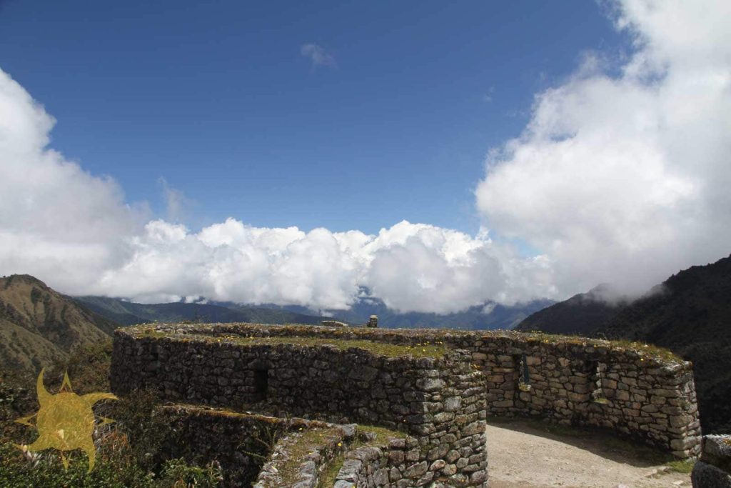
Elevation: 3,850 meters (12,631 feet) Distance from start: ~22 kilometers Arrival time: 1:00-2:00 PM (Day 2 afternoon, after Dead Woman’s Pass) Time at site: 15-20 minutes Condition: Well-preserved, compact site
Historical Context
Name meaning: “Runkurakay” = “Egg-shaped Building” or “Basket-shaped” (Quechua) Function: Military checkpoint and tambo (rest station) Unique feature: Only circular/semicircular major structure on trail Strategic position: Overlooks valley approach, ideal defensive location
Architectural Features
Circular design:
- Semicircular outer wall (unusual in Inca architecture)
- Two-story structure (upper floor collapsed, foundation visible)
- Central courtyard with multiple chambers
- Thick walls suggesting defensive purpose
- Watchtower or lookout post function
Construction details:
- Rougher stonework than ceremonial sites (utilitarian purpose)
- Pirca technique (stone + mud mortar) for interior walls
- Niches for storage or ceremonial items
- Doorways facing valley (visual command of approaches)
Site layout:
- Outer defensive wall
- Inner chambers (4-6 rooms)
- Central patio area
- Associated terraces below main structure
What to Look For
Key observations:
- 360-degree views (understand defensive advantage)
- Different construction quality (compare to ceremonial sites)
- Original roof beam sockets (visualize two-story structure)
- Strategic position overlooking valley and trail
- How circular design differs from typical rectangular Inca buildings
Why this site matters:
- Demonstrates military/administrative architecture vs purely ceremonial
- Shows adaptation of building style to specific function
- Illustrates Inca control of royal road access
- Position reveals strategic thinking about site placement
Visiting Context
Day 2 afternoon reality:
- You’ve just crossed Dead Woman’s Pass (exhausted)
- High altitude affects concentration
- Groups often rush through (eager to reach camp)
- This is unfortunate. The site deserves attention.
Pro Tip: Request 5-10 minutes alone at Runkurakay if your guide allows. The circular courtyard, when empty of other groups, offers profound quiet and excellent photo opportunities without crowds.
Site 3: Sayacmarca – Day 2
Location and Timing
Elevation: 3,624 meters (11,890 feet) Distance from start: ~25 kilometers Arrival time: 2:30-3:30 PM (Day 2 late afternoon) Time at site: 30-40 minutes Condition: Excellent preservation, recently stabilized
Historical Context
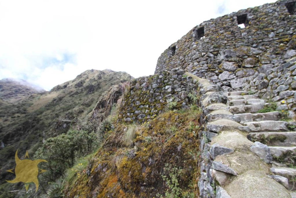
Name meaning: “Sayacmarca” = “Dominant Town” or “Inaccessible Town” (Quechua) Function: Ceremonial center and astronomical observation post Unique aspect: Built atop rocky outcrop (defensive + ceremonial) Population: Small (10-20 residents), elite or priestly class
Why “inaccessible”:
- Perched on cliff face (only one narrow entrance)
- Reached via steep original Inca stairs
- Defensively positioned but primarily ceremonial purpose
- Dramatic setting suggests religious significance
Architectural Features
Site layout:
- Semicircular main structure hugging cliff
- Central plaza (open ceremonial space)
- Multiple levels connected by interior staircases
- Water channels fed by nearby spring
- Observation platforms overlooking valleys
Ceremonial elements:
- Usnu (ritual platform in plaza center)
- Multiple water channels (ritual purification)
- Carved stone surfaces (astronomical alignments possible)
- Elite housing with superior stonework
- Possible solar observation points
Engineering achievements:
- Built on impossible terrain (cliff edge)
- Drainage system prevents erosion
- Retaining walls hold structure against gravity
- Water supply channeled upward via hydraulics
What to Look For
Architectural sophistication:
- Quality of stonework (compare to Runkurakay’s utilitarian style)
- Integrated water features throughout
- How structures adapt to rocky outcrop
- Views from observation platforms
- Evidence of ceremonial use (carved stones, usnu platform)
Comparison point:
- Sayacmarca demonstrates ceremonial architecture at its finest
- Unlike Llactapata (agricultural) or Runkurakay (military), this is purely sacred space
- Foreshadows Machu Picchu’s blend of practical and ceremonial
Photography challenges:
- Afternoon light (often harsh)
- Compact site (difficult to capture scale)
- Other groups in frame
- Best shots: From exterior looking up, from plaza looking down valleys
Expert Insight: Sayacmarca is criminally underappreciated. Its setting rivals Machu Picchu’s dramatic location, yet receives 1% of the visitors. The energy here, perhaps because so few people disturb it, feels more ancient and sacred than Machu Picchu itself.
Site 4: Phuyupatamarca – Day 3
Location and Timing
Elevation: 3,650 meters (11,975 feet) Distance from start: ~32 kilometers Arrival time: 11:00 AM-12:00 PM (Day 3 late morning) Time at site: 30-45 minutes Condition: Excellent, actively maintained
Historical Context
Name meaning: “Phuyupatamarca” = “Town Above the Clouds” (Quechua) Function: Ceremonial center with ritual baths and administrative post Unique feature: Six-tiered ritual bath system (best-preserved on trail) Strategic importance: Final major checkpoint before Wiñay Wayna and Machu Picchu
Cultural significance:
- Water rituals central to Inca religion
- Baths used for purification before entering sacred zones
- Administrative role (tax collection, census)
- Elite residential area (high-status individuals)
Architectural Features
The ritual bath system (most impressive feature):
- Six separate baths descending in tiers
- Fed by natural spring via stone channels
- Excellent stonework (fitted without mortar)
- Each bath slightly lower than previous (gradual descent)
- Original hydraulic system still functional
How the baths worked:
- Water enters top bath from spring source
- Overflows to second bath via carved channel
- Continues through all six levels
- Symbolic purification journey (physical and spiritual descent)
- Used ceremonially before approaching Machu Picchu
Site organization:
- Upper level: Ceremonial plaza, elite structures
- Middle level: Ritual bath system, water management
- Lower level: Agricultural terraces, support structures
- Edges: Observation platforms with valley views
Construction quality:
- Ashlar stonework (finely fitted stones)
- Trapezoidal doorways throughout
- Stone-peg architectural style (protruding stones for tying roof structures)
- Sophisticated drainage preventing water damage
What to Look For
Key features to examine:
- Each ritual bath individually (note craftsmanship)
- Water flow system (observe how channels work)
- Quality of stonework (among finest on trail)
- Trapezoidal niches inside structures
- Panoramic views from edges (understand “town above clouds” name)
Why this site is special:
- Best-preserved ritual bath system on Inca Trail
- Demonstrates Inca water engineering mastery
- Beautiful integration of architecture and landscape
- Relatively quiet (fewer visitors than Wiñay Wayna)
Common guide explanation points:
- Ritual purification importance in Inca religion
- How spring water was channeled uphill
- Social hierarchy reflected in structure placement
- Astronomical alignment possibilities (under research)
Visiting Strategy
Photography golden hour:
- Late morning light ideal (10:30 AM-12:00 PM)
- Baths photograph beautifully with natural lighting
- Clear views toward valleys (when not cloudy)
- Empty of crowds if your group arrives early
Pro Tip: While guides explain the main plaza, walk down to the lower observation platform. The view of Urubamba valley from this spot, combined with solitude away from your group, offers a profound moment of reflection. This is the last major site before Wiñay Wayna, so savor it.
Site 5: Wiñay Wayna – Day 3
Location and Timing
Elevation: 2,650 meters (8,694 feet) Distance from start: ~37 kilometers Arrival time: 2:00-3:00 PM (Day 3 afternoon, before final camp) Time at site: 60-90 minutes (longest stop) Condition: Excellent, extensively restored
Historical Context
Name meaning: “Wiñay Wayna” = “Forever Young” (named for orchid species that blooms year-round) Function: Major administrative center, agricultural production, possible royal estate Scale: One of largest sites on trail (rivals Machu Picchu in sophistication) Population estimate: 100-300 residents (significant for Inca trail site)
Why it stands out:
- Most impressive ruins before Machu Picchu
- Often called “Little Machu Picchu”
- Combines agricultural, residential, and ceremonial zones
- Architecture demonstrates peak Inca sophistication
Architectural Features
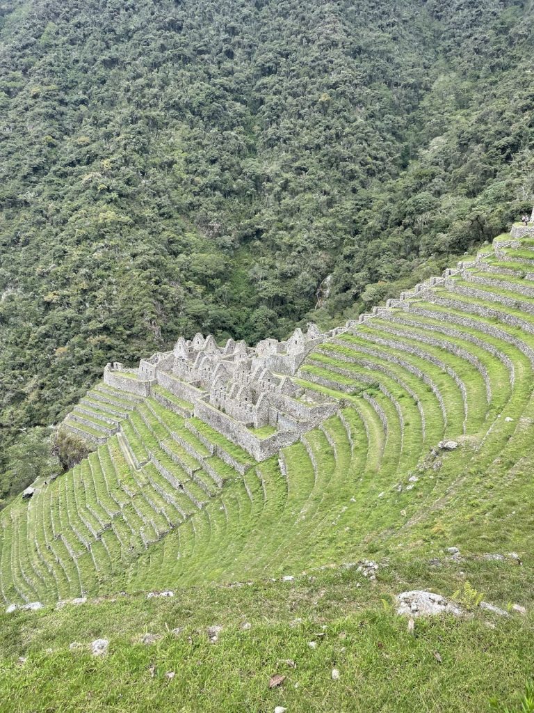
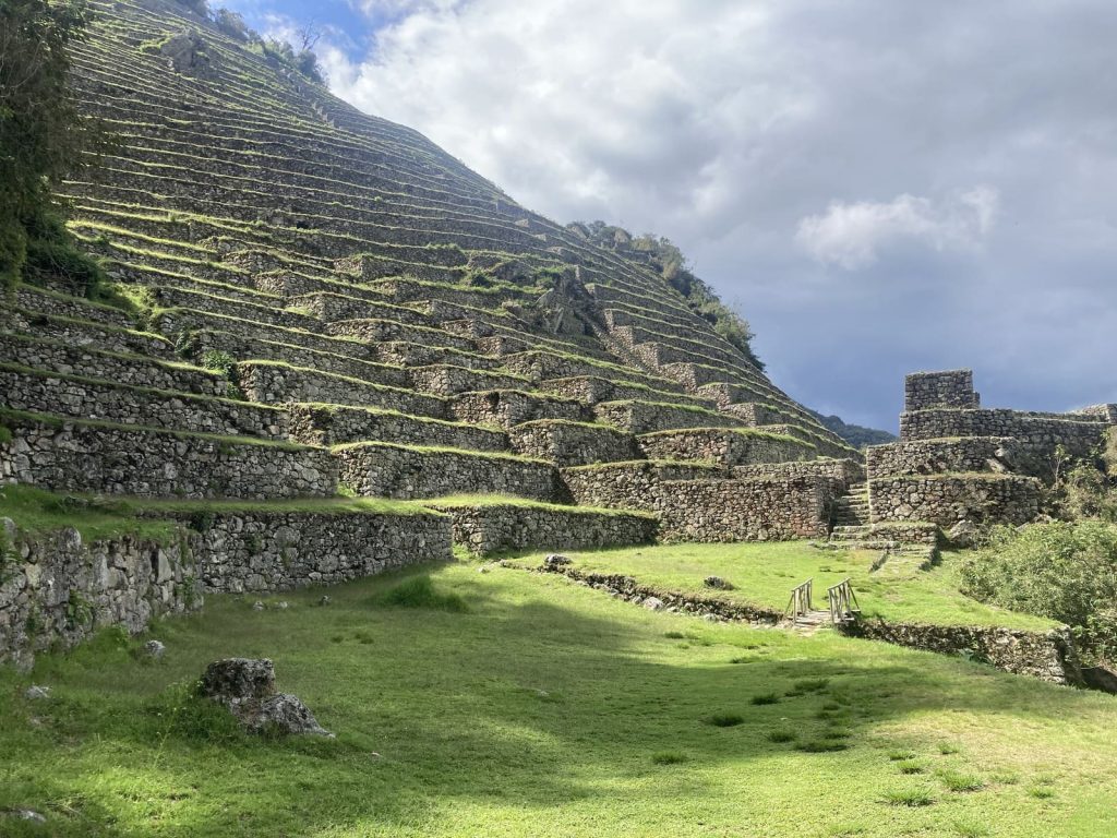
Terracing system (most dramatic feature):
- 10+ levels of agricultural terraces
- Cascade down impossibly steep mountainside
- Original irrigation system still functions
- Crops: Corn, potatoes, coca (sacred plant)
- Engineering marvel: terraces cling to a near-vertical slope
Upper urban sector:
- Temple complex: Superior stonework, ceremonial structures
- Elite housing: Finest fitted-stone technique
- Central plaza: Large open space for gatherings
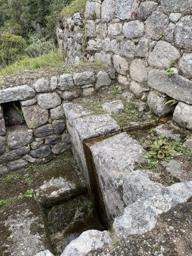
- Ritual baths: 16 fountains (water features throughout)
Lower agricultural/residential sector:
- Terraces: Primary agricultural production
- Worker housing: Simpler construction than upper zone
- Storage facilities: Qolqas for harvested crops
- Support structures: Workshops, service buildings
Water management system:
- Spring source above site feeds entire complex
- Stone channels distribute water to all sectors
- 16 ritual baths/fountains (even more elaborate than Phuyupatamarca)
- Drainage prevents erosion (critical on steep slope)
What to Look For
Architectural sophistication:
- Quality variation: Compare upper temple stonework (ashlar, fitted) to lower worker housing (pirca, rougher)
- Social hierarchy: Physical layout reflects Inca class structure
- Integration: How architecture works with topography
- Scale: True size reveals when viewing from below
Details guides often skip:
- Individual fountain designs (each slightly unique)
- Interior niches in temple structures (ceremonial item placement)
- Stone pegs for roof attachment (visualization of original buildings)
- Drainage holes in terrace walls (engineering sophistication)
- Different construction phases (earlier vs later sections)
Comparison to Machu Picchu:
- Similar terracing style (but Wiñay Wayna more vertical)
- Comparable stonework quality in temple areas
- Smaller scale but equally sophisticated
- Less crowded (major advantage for photography and reflection)
Visiting Context
Timing advantage:
- Day 3 afternoon arrival (good light, less rushed than Day 4 morning groups)
- 4-day trekkers explore at leisure
- 2-day trekkers pass through in pre-dawn darkness (miss it entirely)
- This is THE most under-appreciated major Inca site
Photography opportunities:
- Terraces from above (show cascading effect)
- Terraces from below (dramatic vertical perspective)
- Temple structures with mountain backdrop
- Fountains with flowing water
- Macro shots of stonework details
Expert Insight: Wiñay Wayna is the most overlooked major site on the Inca Trail. Machu Picchu is packed with 3,000+ daily visitors. Wiñay Wayna receives maybe 200 per day, offers comparable architecture, and provides intimate exploration impossible at Machu Picchu. This is many guides’ favorite site, and once you see it, you’ll understand why.
Site 6: Intipunku (Sun Gate) – Day 4
Location and Timing
Elevation: 2,730 meters (8,956 feet) Distance from start: ~41 kilometers Arrival time: 6:30-7:15 AM (Day 4 sunrise) Time at site: 15-30 minutes Condition: Well-preserved gateway structures
Historical Context
Name meaning: “Intipunku” = “Gateway of the Sun” (Quechua) Function: Ceremonial entrance checkpoint to Machu Picchu Significance: Traditional Inca arrival point (royal road terminus) Symbolism: Gateway from profane world to sacred city
Why it’s called Sun Gate:
- Sunrise illuminates Machu Picchu through gateway (winter solstice alignment)
- Sun symbolism central to Inca religion (Inti = sun god)
- Sunrise arrival traditional for pilgrims and Inca royalty
- Spiritual threshold between outer world and sacred space
Architectural Features
Gateway structure:
- Trapezoidal stone doorway (classic Inca portal design)
- Flanking walls and observation platforms
- Guard stations (control access to Machu Picchu)
- Ceremonial plaza area (arrivals would pause here)
Strategic position:
- High vantage point overlooking Machu Picchu
- Commanding view of Urubamba valley
- Natural choke point (easy to control access)
- Final checkpoint before entering sacred city
What to Look For
Architectural elements:
- Trapezoidal gateway (photograph framing Machu Picchu)
- Stone platforms flanking entrance
- Niches in walls (ceremonial or storage use)
- Original stonework vs modern stabilization
Ceremonial significance:
- Imagine Inca pilgrims arriving (as you just did)
- Sunrise illumination (if weather cooperates)
- Spiritual threshold concept
- Last pause before sacred city entry
The modern experience:
- Emotional culmination of 4-day journey
- First panoramic Machu Picchu view
- Crowded with trekkers (everyone stops here)
- Weather variable (clouds often obscure view)
Photography Guide
Classic shots:
- Machu Picchu through Sun Gate doorway (frame within frame)
- Silhouettes of trekkers in gateway at sunrise
- Looking back toward cloud forest (trail you just hiked)
- Close-ups of stonework details
Lighting considerations:
- Morning: Backlit (silhouettes work well)
- Midday: Harsh light (avoid if possible)
- Afternoon: Front-lit (return visit if you have time)
Inca Architectural Techniques
Stonework Styles
Ashlar technique (finest quality):
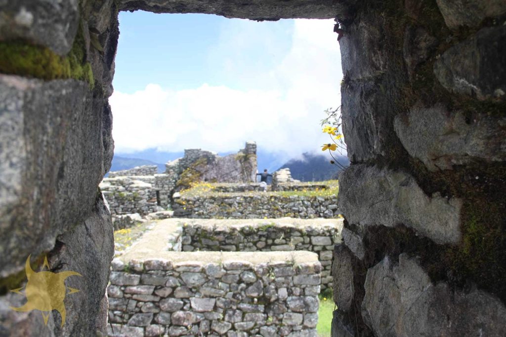
- Precisely cut stones fitted without mortar
- Joints so tight knife blade can’t fit
- Used for temples, royal structures
- Examples: Wiñay Wayna upper temple, Sayacmarca ceremonial areas
Pirca technique (utilitarian):
- Stones mortared with mud/clay
- Rougher fit (faster construction)
- Used for common housing, storage buildings
- Examples: Llactapata worker housing, Runkurakay walls
Coursed masonry:
- Uniform stone blocks in regular courses
- Medium quality (between ashlar and pirca)
- Administrative buildings, secondary structures
Engineering Innovations
Terrace construction:
- Multiple layers (large base stones, gravel, topsoil)
- Drainage holes prevent water buildup
- Slight inward tilt (structural stability)
- Retaining walls withstand earthquakes
Hydraulic systems:
- Gravity-fed water channels
- Pressurized systems for fountains
- Drainage preventing erosion
- Still functional after 600 years
Earthquake resistance:
- Trapezoidal doors and windows (wider at bottom)
- Tight-fitting stones lock together
- Buildings designed to “dance” in earthquakes
- Minimal mortar allows flexibility
Pro Tip: When examining stonework, look for variation in quality within a single site. This reveals social hierarchy: finest work in temples and elite areas, rougher work in common zones. Understanding this makes ruins much more interesting than just “old stone buildings.”
Photography Guide for Each Site
Best Times for Each Site
Llactapata: Morning (10:00-11:00 AM) – soft light on terraces Runkurakay: Early afternoon (1:00-2:00 PM) – good but often rushed Sayacmarca: Late afternoon (3:00-4:00 PM) – dramatic lighting on cliffs Phuyupatamarca: Late morning (11:00 AM-12:00 PM) – ideal for baths Wiñay Wayna: Afternoon (2:00-4:00 PM) – golden hour approaching Sun Gate: Sunrise (6:30-7:30 AM) – classic shot but weather-dependent
Technical Tips
Equipment:
- Wide-angle lens (capture scale)
- 50mm or equivalent (architectural details)
- Polarizing filter (reduce glare, enhance clouds)
- Tripod impractical (keep moving, use fast shutter speeds)
Composition strategies:
- Include people for scale
- Frame ruins with natural elements (trees, mountains)
- Shoot from multiple angles (above, below, sides)
- Detail shots of stonework craftsmanship
- Patterns in terraces and structures
Crowd management:
- Wait for gaps in group flow
- Shoot from less-obvious angles (avoid same spot as everyone)
- Early arrival or late departure (fewer people)
- Include people intentionally (not accidental photobombs)
How Sites Compare to Machu Picchu
| Dimension | Trail sites | Machu Picchu |
|---|---|---|
| Architectural sophistication | Rivals Machu Picchu at Wiñay Wayna, Sayacmarca, and Phuyupatamarca; simpler, utilitarian construction at Llactapata and Runkurakay | Most comprehensive single site: every major Inca architectural style is present |
| Scale | Wiñay Wayna: ~100 structures on 2–3 hectares (the largest trail site); the others: 10–30 structures each | ~200 structures on 5–10 hectares |
| Daily visitors | ~200 across all six sites combined | 3,000+ |
| Visitor experience | Intimate exploration, closer guide attention, less crowd pressure | Superior preservation and infrastructure (bathrooms, guides, facilities) |
Architectural Sophistication
Sites that rival Machu Picchu:
- Wiñay Wayna (comparable stonework, terracing)
- Sayacmarca (ceremonial architecture quality)
- Phuyupatamarca (ritual bath sophistication)
Sites that don’t:
- Llactapata (agricultural focus, simpler construction)
- Runkurakay (utilitarian checkpoint, basic design)
Scale Comparison
Machu Picchu: ~200 structures, 5-10 hectares Wiñay Wayna: ~100 structures, 2-3 hectares Others: 10-30 structures each
Visitor Experience
Trail sites advantages:
- Far fewer visitors (200 vs 3,000+ daily)
- Intimate exploration possible
- Better guide attention (not rushing through crowds)
- Authentic archaeological site feeling
Machu Picchu advantages:
- Superior preservation (more restoration work)
- Comprehensive site (all Inca architectural styles present)
- Iconic status and recognition
- Better infrastructure (bathrooms, guides, facilities)
Expert Insight: If you only had time to see one archaeological site in Peru, choose Machu Picchu. But if you trek the Inca Trail, you’re getting a full course in Inca architecture. Each site shows a different aspect, and together they explain more than Machu Picchu alone.
Conservation Challenges
Threats to Sites
Environmental factors:
- Erosion from rainfall (especially rainy season)
- Vegetation growth (roots damage structures)
- Temperature fluctuations (stone expansion/contraction)
- Seismic activity (Peru is earthquake-prone)
Human factors:
- Tourism foot traffic (based on annual trail permit issuance, roughly 73,000 trekkers per year)
- Touching/climbing ruins (oil from hands, physical pressure)
- Litter and pollution
- Unauthorized excavation (archaeological looters)
Preservation Efforts
Peruvian Ministry of Culture:
- Regular maintenance and stabilization
- Monitoring structural integrity
- Vegetation management
- Archaeological research and documentation
UNESCO involvement:
- World Heritage status (2014) brings international attention
- Funding for conservation projects
- Technical expertise sharing
- Monitoring compliance with preservation standards
What Trekkers Can Do
Responsible behavior:
- Stay on marked paths (don’t create shortcuts)
- Don’t touch, climb, or remove stones
- Pack out all trash (leave no trace)
- Follow guide instructions
- Report vandalism or damage
Conclusion
Most trekkers, exhausted from hiking and focused on reaching Machu Picchu, barely register these sites. They take the mandatory group photos, listen distractedly to guide explanations, and hurry onward. But those who take time to observe (examining stonework, understanding water systems, picturing the original structures) gain a deeper appreciation for Inca achievement that transforms Machu Picchu from impressive ruins into the culmination of architectural mastery witnessed throughout the journey.
These aren’t “minor ruins.” Anywhere more accessible, they would be national parks in their own right. The Inca Trail’s gift is access to sites most people will never see. Use it.
Key Takeaways:
- Six major sites before Machu Picchu, each demonstrating different Inca achievements
- Wiñay Wayna is the star: Rivals Machu Picchu for architecture and beauty
- Architectural quality varies: Reflects social hierarchy (temple to common housing)
- Engineering sophistication: Terraces, water systems, earthquake resistance still impressive
- Best photography: Wiñay Wayna afternoon, Phuyupatamarca late morning, Sun Gate sunrise
- Conservation concerns: 73,000 annual visitors threaten 600-year-old structures
- UNESCO protection: World Heritage status since 2014
- Guides required: Can’t explore independently (protects sites)
- Take your time: Don’t rush. These sites deserve attention and reflection.
- Quiet sites: The kind of uncrowded exploration that’s impossible at Machu Picchu
For the rest of your planning, see the complete day-by-day itinerary, review photography tips for capturing these ruins, check how to train and prepare for the altitude, or start with the complete Inca Trail planning guide.
Related Articles
- Inca Trail Itinerary Day by Day: 42km, Hour by Hour
- 20 Inca Trail Tips for First-Time Hikers (500+ Trekkers)
- The Complete Inca Trail Guide: History, Culture, and Planning
- Responsible Travel
- Inca Trail Packing List 2026: 27 Essentials Under 7kg
- Inca Trail 4 Days: Classic Trek to Machu Picchu
- Animals and Birds on the Inca Trail: 400+ Species Guide
About This Guide: This guide was last updated on August 4, 2026, drawing on field notes from 20+ completed treks, our licensed guides’ years of on-site interpretation at each location, and published documentation from the Peruvian Ministry of Culture and UNESCO’s Qhapaq Ñan World Heritage inscription. For academic research, consult scholarly publications on Qhapaq Ñan and Inca architecture.