
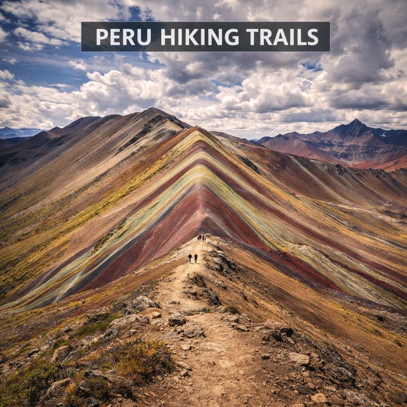
Top Hiking Trails in Peru Trail Map
Peru spans 1,285,216 km² along South America's Pacific coast, divided into three regions: coastal desert (11% of land), Andean highlands (30%), and Amazon rainforest (59%). The Andes run north-south creating parallel mountain ranges with peaks exceeding 6,000 m. Major trekking zones include Cordillera Blanca (highest tropical mountains), Cordillera Huayhuash, and Vilcanota range surrounding Cusco. Rivers drain east to Amazon and west to Pacific, creating dramatic elevation changes within short distances.
Travel Information
Country Code
PE
Currency
PEN (Peruvian Sol)
Language
Spanish, Quechua, Aymara
Capital
Lima
Elevation Range
0 – 6,768 m
Best Time to Visit
May to September for dry trails and stable passes; April and October for fewer trekkers with moderate weather risk
Climate
Trekking conditions vary by altitude and season. Dry season (May-September): firm trail surfaces, stable snow on passes above 4,500 m, nighttime lows -5 to -10°C at high camps, clear visibility. Shoulder months (April, October): transitional conditions, afternoon rain possible, softer trails. Wet season (November-March): muddy trails, daily thunderstorms above 3,500 m, hazardous river crossings, Inca Trail closed February. Cordillera Blanca and Huayhuash follow similar patterns. Colca Canyon (Arequipa) trekable year-round at lower elevations.
Visa Requirements
No trekking-specific visa required. Immigration sets the tourist stay on arrival, usually 90 days and never more than 183 days. For full visa details and entry requirements, see our Peru visa and entry info.
Health Considerations
Altitude sickness (soroche) affects 25-50% of trekkers above 3,000 m. Prevention protocol: acclimatize 2-3 days in Cusco or Sacred Valley before trekking. Ascend no more than 300-500 m per camping day above 3,000 m. Acetazolamide (Diamox) 125-250 mg twice daily, starting 24 hours before ascent. Hydrate 3-4 liters daily. Descend immediately if symptoms worsen. On multi-day treks: carry pulse oximeter, know evacuation routes, ensure guides have supplemental oxygen. Knee strain common on steep Inca Trail descents; trekking poles reduce impact by 25%. Blisters: break in boots 4+ weeks before trek. For vaccination and general health info, see our Peru health and safety page.
Emergency Number
105
Permits Required
Inca Trail: 500 daily permits (200 trekkers, 300 support staff). Must book through licensed operator; individual permits not sold. Machu Picchu entry included with 2026 Inca Trail permits. Salkantay Trek: No permit required except final Machu Picchu entry. Ausangate: No permit. Huascaran National Park: $10-20 entry fee, available at checkpoints. Cordillera Huayhuash: $30 circuit fee, paid at trailheads.
Accommodation
Multi-day treks use porter-supported camping (tents, sleeping mats, dining tent provided by operators) or lodge-to-lodge options on Salkantay and Lares routes ($200-400/night premium lodges). Inca Trail camping at designated sites only; no wild camping permitted. Huayhuash Circuit uses basic refugios at some campsites ($5-10/night) or self-supported camping. Cordillera Blanca base camps have established camping areas. Budget operators provide basic equipment; premium services supply 4-season tents and -15°C sleeping bags. Pre/post-trek accommodation in Cusco, Ollantaytambo (lower altitude, good for acclimatization), or Huaraz near Cordillera Blanca.
🇵🇪 Country Facts
1,555 m
Avg Elevation
Huascaran (6,768 m)
Highest Peak
Geographic Overview
Peru spans 1,285,216 km² along South America’s Pacific coast, divided into three regions: coastal desert (11% of land), Andean highlands (30%), and Amazon rainforest (59%). The Andes run north-south creating parallel mountain ranges with peaks exceeding 6,000 m. Major trekking zones include Cordillera Blanca (highest tropical mountains), Cordillera Huayhuash, and Vilcanota range surrounding Cusco. Rivers drain east to Amazon and west to Pacific, creating dramatic elevation changes within short distances.
Culture & History
Trekking routes follow sections of the Qhapaq Nan (Royal Road), a UNESCO-listed network of over 30,000 km of Inca stone roads. The Classic Inca Trail is the best-preserved segment, with original paving, tunnels, and way stations (tambos) intact. Highland communities along Salkantay, Ausangate, and Lares routes maintain Quechua language, textile traditions, and ceremonial practices predating the Spanish conquest. Porters and arrieros on organized treks often come from these communities. Machu Picchu (15th century) sits at the trail network’s intersection of highland and cloud forest trade routes. ‘The difference between a good Inca Trail experience and a bad one is acclimatization. I see trekkers arrive in Cusco and start at Km 82 the next morning. By Dead Woman Pass they are vomiting and miserable. Two nights in the Sacred Valley changes everything. Ollantaytambo at 2,800 m is 600 meters lower than Cusco, and the sleep quality is noticeably better.’ – Edgar Quispe, AGMP-licensed guide, Cusco (20 years, 500+ Inca Trail completions).
Featured Trails in Peru
Peru at a Glance
13
UNESCO Sites
6,768 m
Highest Peak
76
Protected Areas
500
Daily IT Permits
When to Visit Peru
Dry Season (May-September)
Trail surfaces firm and dry. Passes above 4,500 m have stable snowpack; crampons rarely needed on standard routes. Nighttime temperatures drop to -5 to -10°C at camp above 4,000 m; 4-season sleeping bag required. Creek crossings low and manageable. Inca Trail permits sell out 6+ months ahead. Trails crowded June-August, especially Inca Trail and Salkantay. Visibility excellent for mountain photography. Huayhuash Circuit and Cordillera Blanca routes in optimal condition.
Shoulder Season (April, October-November)
Trail conditions transitional. April: mud drying on lower sections, passes may have late-season snow. October-November: increasing afternoon thunderstorms, particularly above 4,000 m; lightning risk on exposed ridges. Trail surfaces softer but passable. Wildflowers bloom in valleys October-November. Inca Trail permits more available. Fewer trekkers on Ausangate and Huayhuash. Gear note: rain jacket and waterproof pack cover essential.
Wet Season (December-March)
Trails muddy and slippery, especially steep descents. Heavy afternoon thunderstorms daily above 3,500 m. Creek crossings on Choquequirao and Huayhuash routes become hazardous or impassable. Inca Trail closed February for trail maintenance and landslide clearance. Salkantay Trek runs year-round but with reduced visibility and rain. High passes may have fresh snow requiring gaiters. Flash flooding risk in valley campsites. Lower-elevation routes (Colca Canyon, Choquequirao to 3,000 m) remain feasible with proper rain gear.
Practical Information
Trailhead Access
Most Inca Trail and Salkantay treks depart from Cusco or Ollantaytambo (Sacred Valley, 2,800 m). Tour operators provide hotel pickup and transport to trailheads. Independent trekkers reach Km 82 (Inca Trail start) by colectivo from Ollantaytambo (30 min, 5 PEN). Salkantay trailhead at Mollepata is 3.5 hours by van from Cusco. Huayhuash Circuit starts from Llamac, reached by bus from Huaraz (6 hours). Cordillera Blanca treks start from Huaraz (domestic flight from Lima, or 8-hour bus). Colca Canyon treks start from Chivay, 3 hours from Arequipa. For international flights and city-to-city transport, see our Peru flights and transport info.
Trail Costs
Inca Trail guided trek: $400-600 (budget) to $800-1,200 (premium), includes permits, camping, meals, porters. Salkantay guided: $300-800 for 5 days. Independent Huayhuash Circuit: $30 circuit fee at trailheads, plus $50-100/day for food and transport. Huascaran National Park entry: $10-20. Porter/arriero hire: $20-30/day. Camping gas canisters: 25-40 PEN in Cusco or Huaraz. Gear rental in Cusco: sleeping bags $5-8/day, trekking poles $3-5/day, down jackets $5-8/day. Cash required at trailheads and small villages along routes.
Trail Communication
Guides on organized treks speak English and Spanish. In remote highland communities along Salkantay, Ausangate, and Huayhuash routes, Quechua is the primary language; basic Spanish is necessary for independent trekkers. Cell service drops out within 1-2 hours of most trailheads. Satellite communicators (Garmin inReach, SPOT) recommended for independent multi-day treks. Emergency phrases: 'Necesito ayuda' (I need help), 'Estoy perdido' (I'm lost), 'Hospital mas cercano' (nearest hospital). Hut wardens and local arrieros rarely speak English.
Trail Safety & Rescue
Altitude sickness is the primary risk; descend immediately if severe symptoms occur. Licensed guides carry supplemental oxygen, pulse oximeters, and first-aid kits. Independent trekkers should carry altitude medication (acetazolamide), water purification, and emergency shelter. Rescue helicopters operate from Cusco but require clear weather; response times vary from hours to days in remote areas. Travel insurance must explicitly cover trekking above 4,000 m and helicopter evacuation. Register treks with local park authorities. River crossings on Choquequirao and some Huayhuash routes become dangerous during wet season (December-March). Lightning risk above 4,000 m during afternoon thunderstorms.
Emergency Contacts
National Police Emergency
10524/7 emergency police response. Free from any phone. English may be limited; request translator if needed. WhatsApp: 964-605-570 for text communication.
Tourist Police (DIRTURE)
+51 1 460-1060Specialized police for tourist assistance. English-speaking staff in major cities. Cusco office: +51 84 249-654. 24/7 WhatsApp: +51 980-122-335 (iPerú tourist service).
SAMU Emergency Medical
106Free ambulance service (Sistema de Atencion Movil de Urgencia). Available nationwide. No English guarantee; have Spanish speaker assist if possible. Alternative: EsSalud Emergency Transport (117).
Fire Department
116National fire brigade emergency response. Available 24/7. Free from any phone. Coordinates with police and medical services for emergencies.
Red Cross Peru
01-266-0481Emergency medical assistance and evacuation coordination. Emergency line: 115. Operates ambulance services in Lima and major cities. Can coordinate high-altitude rescues with Mountain Rescue teams.
Peru Trail Regions
Cusco
Cusco Region offers world-renowned trekking routes including the Classic Inca Trail, Salkantay Trek, Lares Trek,…
Frequently Asked Questions about Top Hiking Trails in Peru
Fitness requirements vary by trail. Classic Inca Trail requires moderate fitness: ability to hike 6-8 hours daily with 10 kg pack, including 1,200 m ascent to Dead Woman’s Pass (4,215 m). Salkantay demands higher fitness due to 4,600 m pass and 46 miles over 5 days. Ausangate and Huayhuash circuits require expert fitness: multi-day high-altitude trekking above 4,500 m, technical terrain, self-sufficiency. Train with loaded backpack hikes 3-4 months before departure. Cardiovascular conditioning essential for altitude.
Altitude sickness (soroche) affects 25-50% of trekkers above 3,000 m. Prevention: fly to Lima (sea level) first, spend 2-3 days in Cusco (3,400 m) before trekking. Ascend slowly: gain no more than 300-500 m elevation per day when camping above 3,000 m. Take acetazolamide (Diamox) 125-250 mg twice daily starting 24 hours before ascent. Stay hydrated: 3-4 liters water daily. Avoid alcohol first 48 hours. Symptoms: headache, nausea, fatigue, insomnia. Descend immediately if severe symptoms occur. Emergency descent can save lives; never ignore worsening symptoms.
Book Inca Trail permits 6-8 months advance for peak season (May-September), 3-4 months minimum for shoulder season (April, October). Daily limit: 500 total permits (200 trekkers, 300 support staff). July-August sells out fastest. Must book through licensed tour operator; government doesn’t sell individual permits. 2026 permits automatically include Machu Picchu entry. Permits non-refundable, non-transferable. Passport details required at booking; must match passport used during trek.
Inca Trail legally requires licensed guide; solo hiking prohibited. Salkantay, Ausangate, Huayhuash permit independent trekking but guided tours recommended for first-timers. Guides provide: route navigation, emergency response, cultural interpretation, gear transport via porters, meals, camping equipment. Independent trekkers must arrange: permits, accommodation, food resupply, emergency communication (satellite device), navigation (GPS/maps), altitude medicine. Remote areas have minimal rescue infrastructure. Guides speak English, trained in wilderness first aid, know weather patterns. Budget operators: $400-600 for 4-day Inca Trail. Premium operators: $800-1,200.
Altitude prevention is the top priority: acclimatize 2-3 days in Cusco (3,400 m) before trekking, ascend no more than 500 m per camping day, carry acetazolamide (Diamox). Knee protection: use trekking poles on steep descents (Inca Trail Dead Woman’s Pass, Choquequirao canyon). Water: treat all water on trail with purification tablets or UV filter. Break in boots 4-6 weeks before departure. Carry blister treatment, sun protection (SPF 50+, UV intense above 4,000 m), and lip balm with SPF. For vaccination requirements and general health info, see our Peru travel guide.
June and September offer the best balance: dry trail surfaces, stable high passes, and fewer trekkers than the July-August peak. May is excellent but cold at high camps (-5 to -10°C above 4,500 m). July-August has the most reliable weather but crowded Inca Trail and Salkantay campsites. April and October are viable with rain gear; trail surfaces softer, afternoon showers above 4,000 m, but permits more available. Avoid December-March for high-altitude routes (muddy, thunderstorms, river crossings hazardous). Inca Trail closed February. Choquequirao and Colca Canyon feasible in shoulder wet season.